 |
| Nov. 24 - Kinsman Ridge Trail to Cannon - Franconia Ridge & Rt 93 visible |
 |
| time to hang up the 3-season hikers! |
When John and I ascended Mt. Carrigain on the 13th of October, there was already ice and snow in the upper elevations. We didn't need to use our
Microspikes, but we carried them anyway, just in case. The wind chill at the top of Carrigain's observation tower - from which the views in all directions were simply amazing - was at about zero degrees. Though autumn was clinging desperately to the mountains, winter was upon us.
Since then, I've gotten up to the Whites three times, in October and November. I took the month of December off, aside from local hikes at the Middlesex Fells Reservation in Malden, MA, the Blue Hills in Milton, MA, and the Breakheart Reservation in Saugus, MA. All are nice hikes, with fairly challenging terrain; I think I'll write a blog post about my favorite dayhikes around Boston, at some point soon. But none can hold a candle to the rugged and remote White Mountains.
My first post-48 White Mountain hike was just the weekend after my final two peaks. I signed up for an October 20/21 Meetup hike with the
Random Group of Hikers - a great group - on a whim, without even considering taking a weekend off. I guess I was on a roll. It was a two-day backpack to
The Bonds . The Bonds - made up of
Mt. Bond (4698'),
Bondcliff (4265'),
and
West Bond (4540') - are one of the most beautiful and remote spots in the WMNF. I did them early on in my 4000 footer list, in
May of 2012. I was very glad to get back up there, with a great goup of folks.
 |
| Mt. Zealand wooded summit |
|
It was a tough hike, trekking in from Zealand Road, up to the hut, and up to Zeacliff. We took a break on the cliff, taking in the sweeping view and eating snacks. A lot of groups were out on the trails, and though the going was muddy, the weather was great and everyone was in high spirits. We traversed the summit of Guyot, braving a ferocious, cold wind, but enjoying gorgeous views in every direction. After hiking a rough 7.7 miles, we dropped gear in the Guyot shelter and hit the Bonds. When I did this trip myself, I waited for the second day to do the Bonds, and doing it all in one day was taxing, I had to admit - but the view from Mt. Bond is one of my favorites in these mountains. Sun was setting as we climbed onto West Bond, and night fell soon after we arrived back at the shelter. We made a quick supper, hung our food away from the bears that always seem to be lurking around, and slept soundly. With the addition of the Bonds, we'd conquered almost 13 miles on the first day.
 |
| Heading up to Moosilauke's summit |
|
The next morning we began the nearly three mile hike up to South Twin. Everyone hiked strong, and the conversation veered toward winter gear preparations, AMC training courses, and Appalachian Trail memoirs. The ascent to South Twin was tough, but not so much as the route from Galehead: now
that's a climb. The weather was becoming cloudy and misty, and by the time we hit the South Twin summit it was sleeting pretty consistently, and very windy. We ate a quick lunch, crossed the col to North Twin (no views this time which was a bummer -- the
first time I was on N. Twin the views were incredible), and headed down the N. Twin trail. This is brutally steep at first, going down, and eventually evens out, and just seems to go on and on. Near the end, we bushwacked along the Little River in order to several of the crossing sthe trail - somewhat inexplicably - takes. Over the last couple of miles it opens up to a wide leaf-carpeted path, and after what seems like a long time, we made it to the parking lot, where Emmy Vue waited to take us back to the starting point. Mileage for day 2 was 8.4. We sealed the deal with beers and grub at the Woodstock Inn, and all went home. I'm sure I'll run into some of these folks again on the trail, and I look forward to it.
 |
| Chocorua Lake |
On November 11, Me and Dana and Gretel, along with John and Condee decided to meet up and hike
Mt. Moosilauke (4802').
This peak was the
first I summited in 2012, in April. It's known as "The Gentle Giant", ostensibly because it's a quite large mountain, with a bald summit and fantastic views, but with fairly gentle grades up to the top. The relatively easy approach from the south (not the Beaver Brook trail, however, which corresponds with the AT, and is quite difficult) and its convenient location for visitors from Boston make Moosilauke a very popular above-treeline summit.
The night before we stayed in Wonalancet, with friends of ours in their farmhouse. It's a beautifully quaint little area that screams "New England", with the mountains of the Sandwich Range in the north towering over farm fields, whitewashed churches and colonial cemeteries. That evening we did a quick hour-long shake-out hike up to
Mt. Katherine, a 1380' mountain with a nice view east. We had a great homecooked meal and some good conversation and turned in early. We were up with the sun.
 |
| Windy Moosilauke summit |
|
We stopped by Chocorua Lake to take some pictures in front of the mountain reflecting into the glassy morning water, and hit Route 16 north, and took the Kanc west. There was light drizzle and fog but burned off as we headed toward Lincoln, where we'd be meeting John and Condee at the McDonald's, and then onto Moosilauke. We drove up the Ravine Lodge Road from 118 (this road closes in winter adding a couple of miles to the hike - call the Forest Service if you're unsure) and hit the Gorge Brook trail. Winter had come to the mountains, not officially, but the woods are beautifully adorned in snow. Aside from Dana's water bladder bursting at the start of the hike, no mishaps occurred, and it was a great time. We gained altitude and hit treeline at about 3 miles in. The top of Moosilauke is always beautiful - and terribly windy, it seems - and this day was no exception.
 |
| Moosilauke, tryin' the spikes out |
After a beautiful trek across an alpine field and a final scramble up to the rocky, exposed summit, we took a couple of pictures and took refuge from the wind behind a rock to eat lunch. The views, especially of snow-capped Franconia Ridge, are wonderful. It was cold and the wind howled, and we wasted no time getting going again, down the Carriage Road, this time sporting our Microspikes to aid in tracation. It's amazing how elevation can change your surroundings - within half an hour we'd gone from a snow-blown summit to a warm, sunny, nearly-snowless trail. We ditched our spikes, took the Snapper Trail through the woods back to Gorge Brook, and to the cars. It was a great day for a hike, and we all went out to the Woodstock for some beer and food. I can't recommend Moosilauke enough for a manageable dayhike that brings you quickly and easily above timberline, and you can be back in Boston before dark.
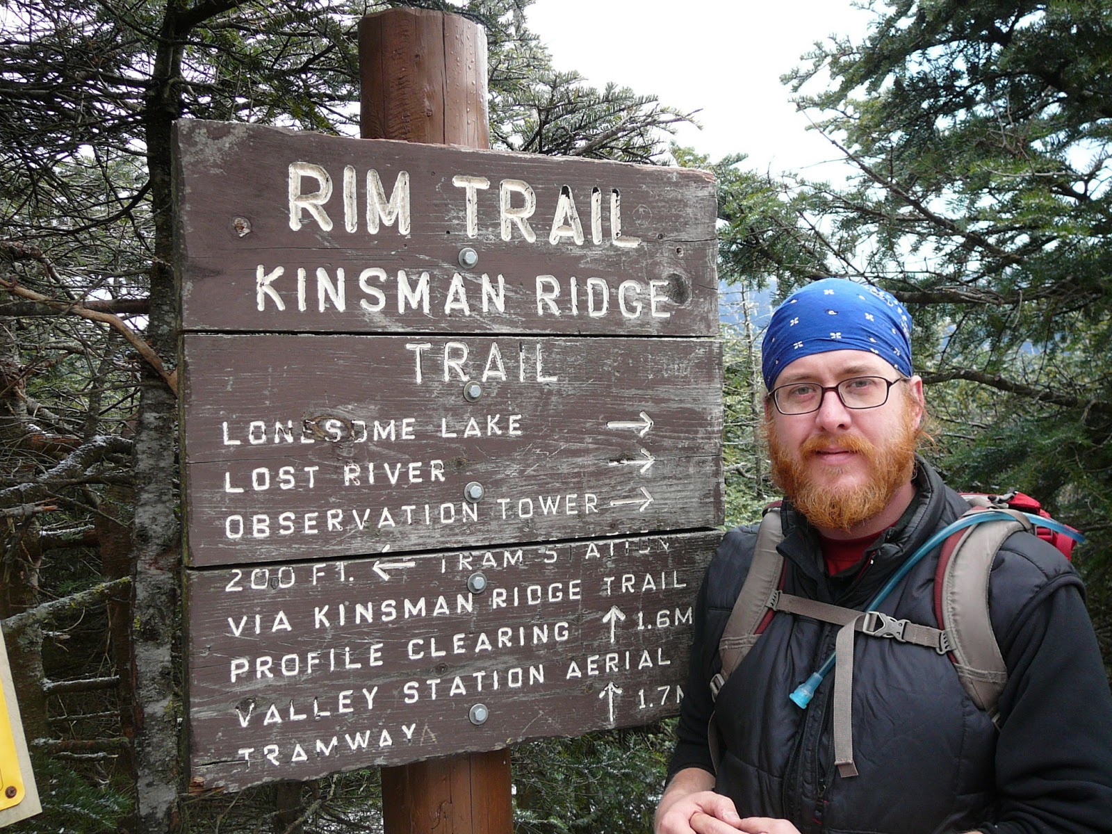
My second trip up to the popular ski destination
Cannon Mountain (4100') was with a Meetup group on November 24. We met up at about 7:30 at Lafayette campground, and carpooled north a couple of exits to head up the Kinsman Ridge trail. I hadn't been on this section of the trail before -
when I came in June, I went up to Lonesome Lake first - and the trail up to Cannon on the Kinsman Ridge was very challenging, pretty much straight up along a ski trail. The group was moving quick, and though it was cold we built heat quickly and layers were shed. I sort of prefer trails that give you some time to warm up before hitting a lot of elevation - the Signal Ridge trail up to Carrigain comes to mind - but this trail goes up steep pretty much straight from the parking lot. We all paused at a super overlook at about 2 miles, with sweeping views of Franconia Ridge over Rt. 93.
 |
| rough trail to Cannon |
The trails grew icy, and we put on our Microspikes to help us get up. We were up at the observation tower of Cannon soon; the last time I was up there, so were a bunch of bikers who took the ski tram up, on a sunny June day. Not this time; the tower was frigid. We didn't linger, heading down the trail again toward the Cannon Balls, the three peaks adjacent to Cannon, west along the Kinsman Ridge. It's rough but beautiful terrain that is a challenge on every front; steep hand-over-hand scrambles, icy ledges, muddy cols. Sometimes spikes are absolutely necessary to traverse an icy outcropping, but sometimes on the wet trails or snowless granite, the spikes make it tougher. Trekking poles help in some spots, but are a hindrance when two hands are needed to maneuver a craggy spot or climb up a steep embankment. Blowdowns were everywhere, and at points we had to crawl under felled trees on our bellies on the icy trail. This is some of the toughest hiking in this area, no doubt.
 |
| view from Cannon tower |
After more than three miles of exceedingly challenging hiking, we got to the junction of the Fishin' Jimmy trail, near the Kinsman Pond Shelter. We took a welcome break and ate some lunch. The plan for the day was to hit North and South Kinsman, then back to this point, down Fishin' Jimmy to Lonesome Lake, then out to the carspot. However, some of the group decided to skip the Kinsmans and head down to Lonesome Lake; I decided to continue on to the Kinsmans, and split into two groups. But, about half a mile down the trail, I hit a wall. Not sure what happened; it could have been sight of North Kinsman looming up over the trail; or the fact that I might have pushed myself a little hard on the way up; or not enough high-energy food; or the fact that cold weather hiking draws more resources from your body; but I lost the mental battle, felt all the energy drain from my legs... and decided to turn around. I was a bit disappointed in myself, but it's important to recognize your limits; there's too much at stake. I headed back down and hit the Fishin' Jimmy trail, chasing the group that decended it before.

I hiked up the Fishin' Jimmy trail in the summer, and I remembered it being pretty tough. Going down it when it's covered in ice was very challenging indeed. At some points, when the trail it basicaly just a steep sheet of ice blanketing rock, I just sort of stood at the top and thought "Well, how the hell do you do this...". There was a lot of slipping and sliding and holding on to trees, but I managed to get down it, no worse for wear. Under the right circumstances trails like this can actually be pretty fun, but on this day I was cursing the trail in loud and colorful ways. After a while Lonesome Lake presented itself. I went into the hut and found the folks in the group that had come down earlier, warming up and eating snacks at one of the large wooded tables. The caretaker had a fire going, and it was quite cozy. We chatted about our travails on Fishin' Jimmy; I refueled, refilled my water, changed my socks, and stretched my legs. I wondered where the group that hit the Kinsmans was right about now.
We got going, leaving the warmth of the hut, hiked along the edge of Lonesome Lake to the trail that would bring us back to the Lafayette parking area. The sun was growing low in the sky; we'd need headlamps soon. The Lonesome Lake trail is a cakewalk compared to everything we'd accomplished that day, which was nice. We were hiking by headlamp as snowflakes began to fall - I'd never hiked in the dark while it was snowing before - a new experience. The "fast" group that had gone to the Kinsmans caught up with us about a half mile from the parking lot - they were hiking fast! We got back to our cars; congratulated each other on a job well done, and said our goodbyes. Around 10 miles for us who cut it short, more like 13 for the others, on some hardcore trails. I headed home, and slept well that night.
So I'm caught up! My next big hike will probably be a Meetup hike to Whiteface (using my new snowshoes, hopefully), and I'm planning on writing an entry about my favorite places to hike around Boston. Til then...
 |
| happy trails! |

 So as a young adult, and even after my relocation to New England, I generally saw winter weather as a cue to go inside and hole up. I've skied on water, but not snow. Before last weekend, I'd never put my foot in a snowshoe. But the beauty of the White Mountains is too important to me at this point in my life to sit around and wait for spring to roll around. Though I started my 4000-footer list in May of last year, when snow still clung to the trails, last winter was mild and spring came early. I hiked all through the spring, summer, and fall. I hiked in blistering heat and humidity, that some people will avoid at all costs, but that I never minded so much, maybe due to my Southern origins. But winter hiking is new and scary to me. The fact that people voluntarily - for recreation - deck themselves out in neoprene and Gore-Tex and wool and drag a heavy pack up the side of a frozen mountain, all for the pleasure of having a eighty-mile-per-hour wind blow frozen ice pellets at their face is still a bit mysterious to me. But, the mountains call me, and I have little choice but to join the shivering throngs and heed their invitation. I'm not just a three-season hiker anymore.
 My first official winter White Mountain hike was on January 12, 2013. It was a well-attended Meetup outing to Mt. Whiteface, a 4020' peak in the heart of the Sandwich Range, and the southernmost 4000-footer in the White Mountains. I climbed this mountain in July, approaching from the Kanc, and pairing it with Mt. Passaconaway to make for a long, hot dayhike. This time, we approached from the South, from Ferncroft Road in Wonalancet, and took the Blueberry Ridge trail all the way to the summit. I'd picked up two other "Randomites" (members of the Random Group of Hikers Meetup group), one from Cambridge and one from Somerville, at about 5:30, and we were on the road at 6. We arrived at the trailhead at about 8:30; the early morning temperatures were hovering around freezing. Weather reports of icy roads were forecasted, but the roads were in pretty decent shape all the way to the parking area, near a large snow-covered field, and we joined a large number of cars and hikers getting their winter gear ready to go. The weather was overcast and the air was moist, but it was relatively warm, and it was certainly nice to be back in the Whites after taking December off. We met up with our group, which numbered about twelve; the largest group I've hiked with so far. Above and beyond our group, there were a bunch of other folks also heading up Whiteface. The leader/organizer greeted us, and we went around in a circle and introduced ourselves. After doing a gear check and making sure everyone's snowshoes were attached securely to their packs, we headed off to the trail.
 It's hard to emphasize how important layering and sweat management is when hiking in the winter. For this hike I wore my Patagonia Capilene baselayer (top and bottom), a thicker Patagonia sweater, and my Eddie Bauer insulated vest that I found in the curbside trash one night. Funny, the one piece of clothing that I'll probably wind up using the most this winter I got for free. I used my Nike mid-weight running pants, which I like a lot for hiking pants, and they also make a pretty good mid-layer on really cold days. I topped it all off with some high winter gaiters I got at Ocean State Job Lot for 12 bucks - always be on the lookout for deals! I hiked in this for most of the day, but also carried my OR down sweater, North Face fleece, and Arc'teryx rain shell for breaks, or in case the weather changed.


