Monday, April 8, 2013

Southbound: Why I'm Hiking the Appalachian Trail

AT sign in Western Mass
I stepped off the bus and the wind hit me like a bucket of water; it was at least twenty degrees colder than it had been in Boston. I'd put on my fleece and zipped on my pants in my bus seat, as I noticed the aluminum frame around the plastic window growing colder against my arm. It was October in New Hampshire, after all, and I knew it would be chilly, and was more or less prepared. I'd read the books and blogs about down versus synthetic, Nalgenes versus bladders, and for God's sake don't wear cotton anywhere near a mountain or they'll be pulling your hypothermic corpse down the trail on a makeshift sled before you can say "those clouds look a bit ominous..." I watched the bus putter north into the dark toward Gorham, growing small, progressively drawfed by the massive mountain walls plunging down to Routh 16. I was standing on the side of the road next to the Pinkham Notch Visitor Center, my new Osprey pack clean as a whistle, and I was about to get a crash course in hiking in the White Mountains.

I had come up to the mountains to find the Appalachian Trail. I knew it was somewhere up here in the White Mountains, and after a couple of Google searches I came up with the idea of taking the bus - I was carless at the time - to Pinkham Notch Visitor Center, camp, and perhaps hike along the AT; see what it was all about. I hadn't done a lot of hiking since I was much younger, and never in a place like the Whites. I think the last time I'd been here was on a family trip we took in 1989 or '90, when we saw the Old Man in the Mountain, before his unfortunate demise. We certainly didn't hike - it was strictly a car tour - but the experience stuck with me. I remember saying, after that trip, that I wanted to move to New Hampshire. I don't know why it took me so long to get back up here, but here I was, on some kind of vague quest I couldn't even explain to myself, inexplicably drawn to a trail I'd never set foot on.
One of the white blazes on the AT

On the phone, when I called PNVC to ask about the camping situation, the person at the desk told me I should camp at Hermit Lake, and that it was a "quick hike" up from the road, and hiking it at night - my bus arrived well after dark - shouldn't be a problem with a flashlight or headlamp. Great, I thought, and pictured a minutes-long walk over a grassy knoll to my campsite. To anyone familiar with the area, this is clearly not the case; it's a 2+ mile hike up the bouldery, rocky Tuckerman Ravine Trail. As crazy as that recommendation was on their part - they should have asked my familiarity with the area and experience level - I was also unprepared; I did almost zero internet research on the area, didn't look at trail reports or even a map. Even if I had, I had no concept of how difficult a White Mountain mile could be. None of this mattered, however, since when I went into the Visitor Center, new pack on my back, they told me that there was no room at Hermit Lake, anyway, and the Joe Dodge Lodge was full for the night.

"So... what do I do? I was told there would be room at Hermit Lake." "Well," the man cogitated nonchalantly, as if telling me where to find more coffee lids, "You can hike up into the Great Gulf Wilderness and stay at the Osgood tentsite. There might be room there." I didn't know what any of these words meant. He traced a trail on a map that was laminated to the counter. I stared at it, blankly, knowing that wasn't going to happen. I didn't even have a tent - they had told me I didn't need one, since Hermit Lake has several lean-tos (or shelters) you can stay in. I was trying to conceal my panic. I didn't have a car so I couldn't either sleep in it, or drive down to Gorham, or find a campsite near the road. I was kind of stuck here, and the best advice I could get was to hike five miles, in the dark, on rugged trails, to a site that may or may not be full. If I had done this, I would have discovered that this route is on the Appalachian Trail, something I'd learn later. While the gears in my head spun uselessly, a man next to me piped up, "We have an extra bunk in the lodge."

hiking down from Hermit Lake
I was flush with relief, agreed to it happily, and we squared away the details. While there are some private rooms at the rustic Joe Dodge Lodge, the bunk rooms are tight, sleeping hikers stacked three high. As I laid sleeplessly in my last-minute, wrong-place-right-time bunk, listening to hikers rustle and snore, a beastly storm blew in, and it rained and thundered without mercy for hours. I wondered what would have become of me if I'd hiked up into the Great Gulf.

The morning was beautiful, sunny with a crisp coolness in the air. I went back to the front desk and bought a map and compass - yeah, yeah, I know - and they recommended I hike up to Lowe's Bald Spot. Lowe was apparently a fellow in the Victorian age, who discovered this little bald that was relatively easy to get to and afforded a sweeping view of the Northern Presidentials, and he'd escort his socialite friends up for the day, women in hoop skirts and bonnets and all. It was a pretty quick hike; I clambered up to the top of the spot and saw my first real White Mountain view. "Well, I could get used to this," I said to myself, and drank in the view for quite a while. This was the first time I hiked on the AT, following the famous white blazes up to this little summit, and I don't know quite how to describe it, except - it felt right. That night I did finally make it to Hermit Lake and slept (on a raft I was using as a sleeping pad, which was surprisingly effective) in a shelter with a group of great folks, and hiked out and was on the bus home the next day.

So, why was I looking for the Appalachian Trail? Why am I attempting to thru hike it, two and a half years later? I don't quite know the answer to that. A seed got stuck somewhere in my consciousness a while ago, and it just seemed to grow. It's why I've educated myself about hiking, and the outdoors; every piece of gear I've bought, every mountain I've summited, I've had an eye to hiking this great American trail. Since I was a kid I've dreamed - literally and figuratively - of turning my feet to a path and just going. Just the thought of it is therapeutic; a soft gaze toward an adventure like this has assuaged a lot of pain and anxiety I've had over the last few years. I'd like to think I'm not running from anything, but instead going to find something; not sure what yet. And, I might make it to Georgia, and I might not. But I have to try. The time I spent in the Whites fixed something in me - I don't know how else to put it - and the AT attempt is a natural progression; a long green passageway into a more peaceful, focused life. I hope.

So, this is the year. I've arranged the time off from work, and am moving out of my house at the end of May. The stars have aligned, and beginning in early June, I will begin hiking South. Dana will come for the Hundred Mile Wilderness, and from there I'll go solo. For those who don't know, it's over 2100 miles, from Mt. Katahdin in Maine to Springer Mountain in Georgia, and typically takes 5 or 6 months to walk. I'll try to keep in touch, hopefully have the time and energy to write meaningfully about my journey, and I certainly hope some of my friends who enjoy the outdoors will come join me for a day or two on the trail. I have amazing people in my life, and I hope this odyssey will somehow make me more deserving of them. See you on the trail.

Sunday, March 31, 2013

Gray Jays and Sunny Summits: the Hancocks

I've been negligent in my blogging and let a couple of weeks elapse between my last White Mountain hiking trip, and writing about it. I like to do it as soon as possible, because the details are clearer in my mind, but I happen to be extremely good at procrastinating. But I took a lot of pictures that I happen to like a lot, so I definitely wanted to post something for that purpose - I've also been enjoying making those silly headers too.

On March 9, my buddy Scott and I met at the McDonald's in Lincoln at about 8:30, ready to tackle the Hancocks. The forecast looked great, and it was; extremely sunny and forecasted to climb into the high 40's. An ice climbing class had commandeered a large portion of McDonald's dining space, and was busy signing releases and donning expensive-looking gear, before piling into vans in the parking lot and heading out. I was chomping on a egg sandwich and drinking a cup of coffee when Scott came in. We caught up a bit, and then headed out, down the Kancamagus, toward the hairpin turn trailhead. We hit the trail just after 9.


The first leg from the parking lot, on the Hancock Notch Trail, is a breeze, even in the snow. The trail was pretty well packed down, and we sailed along it in just our Microspikes, admiring the warm, sunny, clear day that was presenting itself in the mountains. Most of this trail is covered, but views north open up now and then. The ice bridges on the trail, due to the warming temperatures, are beginning to look a bit unstable, but there aren't any major crossings on this hike, so I wasn't too worried about it.

Dana and I hiked this on January 21, on a much colder day, and I'd done it in the summer, so I was pretty familiar with the approach to the mountain. Dana and I didn't quite make it to the summit, but Scott and I managed to bag both peaks on this trip. When we took a left onto the Cedar Brook trail, we started to see a little bit of elevation, and a bit more after we hit the final 1.1 mile leg that would bring us to the loop. The flat approach has its advantages; you get to warm up a bit before hitting the real climb. But, you're constantly reminded that when the elevation does come, it's going to be fierce. And so it is on Mount Hancock.

We ran into a few other people right around here, most notably a man in his late 60's and his granddaughter, working on her winter 48. He was an interesting guy, and said he'd been hiking in the Whites for fifty years. We talked a bit about the advancements in gear, and the fact that back in the day almost no one hiked out here in the winter; they didn't even plow the Kancamagus Highway in the winter, limiting access to Hancock a whole other slew of mountains. We all kept about the same pace; he was like a lot of other older hikers I've met - a bit old and slightly overweight, but steady and tenacious, with a sunny disposition.


The climb up to Hancock - we took a left at the loop junction to hit the north peak first, going clockwise - is a steep one, to put it mildly. However, the trail up to the north peak is not even as steep as the one that goes to the southern peak. I did it counter-clockwise in the summer, and still remember that rocky climb. Some people say winter hiking is easier, in that everything - rocks, roots, boulders - is covered in snow, hopefully packed down, and all you have to do it "walk up it", and that the snow cushions your steps, taking stress off your joints and muscles. There is truth to that, but I don't happen to think that makes it easier. The extra
Gray Jay on the summit of Mt. Hancock
energy your body uses to keep itself warm in cold conditions, and the extra calories you have to stuff down your throat in order to produce it, negates, for me at least, any extra ease that the snowy conditions might create. I happen to think winter hiking is a hell of a lot harder, when you account for all the extra gear that needs to be carried.

The day was extremely warm and clear, and the climb was tough, and I was pretty wet when we finally made it to the summit; some sweat, some from snow melting from the trees in the 40 degree plus weather. Truly, the longest .7 mile I can remember. But, as is usually the case, the summit more than made up for the climb. A small group was congregated at the top, enjoying the sun. The views from Hancock are not panoramic, but they're excellent, and we dropped our packs to dry out and eat some food. Just a quick aside to talk gear; I finally buckled and sprang for a Merino Smartwool baselayer, and I couldn't be happier I did (apparently, a lot of other people feel the same; the reviews are virtually all raving). My Patagonia Capilene baselayer is okay, but it can't hold a candle to the wool. The Smartwool is warm, even when wet, and doesn't ever feel boggy, and I was dry in minutes in the sun. It wicks so well, you can actually see the water droplets being pulled through the fabric and beading on the outside, ready to evaporate. Pricey, but worth every penny.

Feeding cashews to the Jays
My favorite part of the hike was here, on Hancock's bright summit, thanks to some friendly Gray Jays that showed up for what these friendly little creatures usually come for: food. They fluttered around the perimeter of the summit, clearly interested in us, and when we'd hold out a nut, they'd come and land on our hands, grab the treat in their beak, and fly away. They wouldn't eat it right away, so far as I could tell, so we reasoned that they were likely squirreling it away in some undisclosed location. I'd had a visit from a Gray Jay before - I think at Garfield Ridge campsite in the summer - but had never had this close contact with them. It was a very cool experience.

After feeding the birds and feeding ourselves, we packed up and headed down the connecting loop trail toward the South summit. Shortly after descending into the col between the two mountains, Scott and I decided to put on our snowshoes; the snow was not as packed here, possibly due to fewer people traveling the whole loop. We made pretty good time, and encountered some excellent views of Franconia Ridge on the way up to South Hancock. This summit is more wooded, but there's a outcropping nearby with some good views to the east and south. We ate more here (in winter, eating every time you stop is basically essential), chatted more with granddad and granddaughter, and headed down the steep trail to complete our loop.

This descent was tough - we could have done a butt-slide (or glissade, if yer fancy), but I'm still not quite comfortable with it, and so I just walked down with my snowshoes, as best I could. Scott and I both wiped out a couple of times, sliding inadvertently a yard or two before arresting ourselves by grabbing a tree or digging our feet into the snow. It was slow going, and torture on the quads. After an arduous half a mile, we got back to the junction and headed out the way we came. It was soon after that we
snow-capped Franconia Ridge from the loop trail
ran into a couple of young men - late teens or early twenties - who were heading up with no apparent gear of any kind. One held his jacket casually, and neither seemed to have any water or food. This was surprising, and I asked where they were headed. "To do the loop." It was well after 3 o'clock at this point, and there's no way they'd be back out before dark, in my estimation. I asked if they had a headlamp and they said yes, but I didn't really believe them. They asked if we were camping out due to "all our gear", but we said no. We wished them the best, and I hoped we wouldn't be reading in a few days about two young men found half-frozen in the White Mountains. On the way back to the Cedar Brook trail, we noticed a camp set up, and figured it was theirs and that's where their gear was; still, just hiking the loop with no supplies is a pretty foolhardy thing to do, especially in winter.

We got back to the car around 5, after managing to cross some sketchy ice bridges that had seen considerate loss of mass just since the morning, due to the warm day. Our plan was to do Moriah the next day, so we headed down the Kanc east, and up 16, toward the north country, and stopped at Pinkam Notch Visitor's Center to see about getting some grub. Unfortunately, they were full up, and out of dinners, so after consulting with the crew about the best way to tackle Moriah, we continued up to Gorham and hit the local Italian place, where we ate pasta in various forms, topped with copious amounts of cheese and sauce. It hit the spot. We headed up to the Hiker's Paradise, where I'd procured a room with two beds for about 60 bucks, a pretty good deal. The man at the desk was eccentric and funny (at least he was trying) and spoke with an Eastern European accent, and told us we only had to fill our our car license information if we were "planning on causing trouble." We were not, I assured him. They had turned on the heat in our room prior to our arrival, and it was pretty cozy - certainly not fancy but all you need after a 10 mile winter hike. We watched part of an episode of Star Trek (TNG) and crashed hard.

The Northern Presidentials from Mt. Surprise
We were up at about 8, and packed up our stuff that had been drying overnight. We grabbed some coffee at the gas station and headed to the trailhead that would take us up to Moriah, off of Bangor Road, a very short distance from the motel. We opted to take the Carter-Moriah trail from the north, as opposed to the Stony Brook trail (finding the Stony Brook trail apparently required cutting through someone's property) and we were soon cruising up what one online report called a "superhighway"; usually a sign that the trail is packed. It was, for the most part, and we used only our spikes for the first couple of hours.

We didn't quite summit Moriah; we got most of the way there, but we were beat from the day before and going slow, and had gotten a pretty late start. So we turned around, which is always a little hard, but it's not always about "bagging" the peak. It was a beautiful, warm day, much like the day before, the forest was quiet and still with snow, and the views of the Northern Presidentials from (what I'm assuming was) Mount Surprise were fantastic.

So was my last winter hiking trip of the year, in the White Mountains. It was my first winter season hiking up there, and I completed four four-thousand-footers, which isn't a lot but I'm proud of them. I "get" winter hiking now; I understand what the die-hards are always raving about. I'm certainly more comfortable in the snowy conditions than I was in December, and I've dialed in my gear a bit. I've relearned things I thought I knew, like how to walk and feed myself properly. I'm glad I did it, glad I bought the snowshoes and water bottle coozy and balaclava, but I won't lie and say I'm not good and ready for the sunny, scrubby summits of summer.


Monday, February 18, 2013

Zen and the Art of Snowshoeing: Carter Dome


I ascended Carter Dome (4832') from the north, on Memorial Day weekend of 2012, on a solo 2-day backpack of the Carter-Moriah Range. Aside from a somewhat harrowing decent from Wildcat Mountain down into Pinkham Notch, it was a beautiful and enjoyable hike, one I'd very much like to do again at some point. The climb up to North Carter after staying at Imp Mountain was one of the most memorable of my time in the Whites.

So I joined a Random Group Meetup trip up to Carter Dome for Saturday, February 16. This time, we'd be approaching Carter Dome from Rt. 16, up the Nineteen Mile Brook Trail. The plan also included summiting Mt. Hight, but we didn't get to it due to the trail conditions; it wasn't broken out, meaning that the trail was covered in powdery, fresh snow, and wasn't packed down yet. It takes considerably more energy to snowshoe on an unbroken trail, and we didn't feel it was worth the effort, since Mt. Hight, known for its exceptionally sweeping view of Mt. Washington, was socked in by fog and clouds, just as Carter Dome was.

I met Jocelyn at the La Quinta inn in Andover at the absurd hour of 4:30 AM, a good two hours before the sun even came up. I left my car in the lot, and she drove up, heading north into some pretty squirrely weather. Reports of a small nor'easter predicted a few inches of snow, but after last weekend's blizzard that dumped 30 inches on Boston (strangely, New Hampshire and Vermont got a fraction of that), a few inches seems like child's play. But Jocelyn maneuvered through the inclement weather well, and by the time we got up into New Hampshire on Rt. 16, it was starting to clear. The sun never quite came out until the end of the hike, but the temperatures stayed pretty steady (I think low 20's at the trailhead and low/mid-teens at the summit) and the wind was very calm, which is always a nice treat. We met up at the trailhead, just past the Pinkham Notch Visitor Center, with the other "Randomites" (members of the Random Group of Hikers), and geared up, and were on the trail by about 8:15.

The only obstacle on this hike was my own brain. It likes to try to psyche me out when I step outside my comfort zone, and winter hiking (at least the kind we did yesterday) is still outside my comfort zone. This was my first big snowshoe, and I've yet to quite dial in my clothing situation. When cold-weather hiking, staying as dry as possible is important, which is why layering is key. I started off wearing a Patagonia Caplilene baselayer, my fleece, and my waterproof shell. A few minutes into the hike, we took a minute to delayer, I removed the shell, and kept going. Despite this, snowshoeing is strenuous and I built up a pretty good sweat, and I started down the "what if?' rabbit hole. what if I get hypothermia; what if I get a muscle cramp; what if all my water freezes and I become dehydrated? What if I just become exhausted, 5 miles in on a snowy mountain, and can't get myself out? It's normal, irrational anxiety/panic stuff I deal with on a regular basis, and when it starts, it's hard to stop, and being in the backcountry - as much as I love it - doesn't help. By the time we reached the top, I did indeed feel exhausted, less from the physical effort - which really wasn't that bad - and more from the constant barrage of negative, spiraling thinking. But, I powered through, trying to remind myself of the fact that I was able and prepared to do this. I thought about the day I did the Presi Traverse, and how much more difficult and treacherous that was, and I did it. There's just something about the cold and ice and snow that still freaks me out, on some primal level. But, I'm working through it, it's becoming more controllable, and I'm sure it will get better. I hate that I can't seem to just enjoy things like this, without becoming a knot of anxiety. But, while hiking brings out these feelings, it also can assuage them. It's almost like therapy; it drwas out these issues in a controlled way, laying them out on the table so I can face them, work through them, and put them behind me. And of course, none of the bad things came to pass. I was cold, but I was on a 4800 foot mountain in February. Cold is part of it. I did get a muscle cramp in my right quad, but it passed. I didn't become exhausted, due to the fact that I was shoving as much food as possible into my face, and drinking water consistently, both of which are extremely important in order to have the energy to burn to keep your body warm. I'm reminded of the Mark Twain quote: “I've had a lot of worries in my life, most of which never happened". 

We hiked along Nineteen Mile Brook, and it was quite beautiful. The brook was mostly frozen and covered in snow, but here and there, holes in the ice reveal waterfalls and small pools, surrounded by icicles and endlessly fascinating formations. The trail was fairly well broken in up to Zeta Pass, when the snow became a bit deeper and hard to navigate. Though everyone wore snowshoes, I think most of the trail would have been navigable with Microspikes, but random postholing (stepping through deep snow due to lack of flotation, creating a "post hole" - bad trail etiquette, and potentially dangerous) may have been a concern. I enjoyed the snowshoeing. I spent some serious cash on some very nice MSR snowshoes, and I have to say I'm glad I did. I've always bought the nicest gear I could afford. When you're miles into the backcountry, you don't want something to fail because you were trying to save a few bucks. The bindings on the Lightning Ascent snowshoes are extremely easy to adjust, even with gloves, and you can walk with a normal stride and they feel natural. Don't skimp on gear, if you can help it. 

The original plan was to go to Mt. Hight, but we instead took the Carter Dome Trail directly to Carter Dome. I remember the top of the Dome was a small clearing, mostly wooded, with an opening in the trees affording a great view northwest. When we got to the summit at about noon, it was socked in and no views were to be had. I layered up with my down OR jacket and my vest, along with my shell, but was still pretty cold. It was in the low teens up there, but the wind was calm. We had a quick lunch, took a summit pic, but headed back down pretty quickly since everyone was starting to get cold. It's part of winter hiking I'm still getting accustomed to; I really enjoy hanging out on a sunny summit, laying on a hot slab of granite, enjoying an extravagantly long summer day and taking my time. That's just not how it is in winter; you kind of have to keep moving in order to keep yourself warm. For me it adds a sense of urgency that I find unsettling sometimes. 

We came down the same way we ascended and made good time, we'd broken the trail on the way up so it was nice and packed for our descent. Free from the rigors of upward travel, we talked a lot, joking and sharing stories about things hikers talk about; gear, triumphs and tribulations on the trail, weather. The people on this trip were great; I'd hiked with John, the leader, and Jocelyn on the Whiteface hike, and the Cannon hike, respectively. I felt like I was dragging a bit on the way up but everyone was encouraging and patient, which really helped get my head out of its funk. I really enjoyed the trip down; finally found my snowshoe stride, finally stopped worrying, and just enjoyed being in such a beautiful place with such interesting folks. About 10 minutes before we arrived at the trail head, around 3 o'clock, we passed a large group of hikers that were heading to the Carter Notch hut, which is open in the winter but "self-serve"; it's not staffed but you can use the kitchen, bunks, and other amenities. They were just starting out and the first couple of miles is pretty easy, but they seemed winded already. They were also carrying a kind of insane amount of gear; one guy's pack reach far over his head and looked to be upwards of 80 pounds. I'm hoping they got there safe, but I'm sure they were hiking into Carter Notch in the dark. I didn't envy them.
topo map at Pinkham Notch Visitor Center

We said our goodbyes in the parking lot, congratulating each other for a job well done. Jocelyn and I hit the Pinkham Notch visitor center a few miles down the road, where we used their facilities to change into some clean clothes. We browsed the store and chatted with the staff about our hike. The PNVC and the adjacent Joe Dodge Lodge is really one of my favorite places on the planet; it's got a great vibe and knowledgeable people, and everyone there is bound by their love for the White Mountains. I bought a copy of The AMC Guide to Winter Hiking and Camping, which I'd been meaning to pick up for a while, and we meandered South, toward home.
parking lot on 16

I've made this out to sound like kind of an unpleasant hike, which is not true at all. That said, I won't lie and say the thought of hanging up my boots till the spring thaw didn't cross my mind yesterday. But this is a process; in the grand scheme I'm still a pretty inexperienced hiker, especially in winter. I'm just going to keep learning, keep dialing in my gear, and keep at it. Because damned if I'm going to let something as inconsequential as anxiety and irrational fear keep me away from the mountains.
 

Distance 10.02 mi
Book Time 6 hr 48 min (almost exactly our actual time)
Elev Gain 3584 ft

Wednesday, January 23, 2013

A Warm(ish) Day on Whiteface

A few years ago, if you told me I'd be hiking in January in the White Mountains, I would have suggested an immediate psychological examination. As much as I enjoyed the outdoors as a kid, I grew up in the South. Heat and humidity are a way of life in the Arkansas delta, along with country music, good barbeque, and "muddin'". But when that rare winter weather blows in, life tends to grind to a halt. Centimeters of snow can close down a major city. People skid off the roads in a panic on their way to the grocery store to frantically buy canned creamed corn. As kids, we prayed for snow - no matter how little - because school would close and there might be enough powder to take the sled down the top of the hill. But usually, it wouldn't stick. And if it did, it didn't stick around for long.

So as a young adult, and even after my relocation to New England, I generally saw winter weather as a cue to go inside and hole up. I've skied on water, but not snow. Before last weekend, I'd never put my foot in a snowshoe. But the beauty of the White Mountains is too important to me at this point in my life to sit around and wait for spring to roll around. Though I started my 4000-footer list in May of last year, when snow still clung to the trails, last winter was mild and spring came early. I hiked all through the spring, summer, and fall. I hiked in blistering heat and humidity, that some people will avoid at all costs, but that I never minded so much, maybe due to my Southern origins. But winter hiking is new and scary to me. The fact that people voluntarily - for recreation - deck themselves out in neoprene and Gore-Tex and wool and drag a heavy pack up the side of a frozen mountain, all for the pleasure of having a eighty-mile-per-hour wind blow frozen ice pellets at their face is still a bit mysterious to me. But, the mountains call me, and I have little choice but to join the shivering throngs and heed their invitation. I'm not just a three-season hiker anymore.

My first official winter White Mountain hike was on January 12, 2013. It was a well-attended Meetup outing to Mt. Whiteface, a 4020' peak in the heart of the Sandwich Range, and the southernmost 4000-footer in the White Mountains. I climbed this mountain in July, approaching from the Kanc, and pairing it with Mt. Passaconaway to make for a long, hot dayhike. This time, we approached from the South, from Ferncroft Road in Wonalancet, and took the Blueberry Ridge trail all the way to the summit. I'd picked up two other "Randomites" (members of the Random Group of Hikers Meetup group), one from Cambridge and one from Somerville, at about 5:30, and we were on the road at 6. We arrived at the trailhead at about 8:30; the early morning temperatures were hovering around freezing. Weather reports of icy roads were forecasted, but the roads were in pretty decent shape all the way to the parking area, near a large snow-covered field, and we joined a large number of cars and hikers getting their winter gear ready to go. The weather was overcast and the air was moist, but it was relatively warm, and it was certainly nice to be back in the Whites after taking December off. We met up with our group, which numbered about twelve; the largest group I've hiked with so far. Above and beyond our group, there were a bunch of other folks also heading up Whiteface. The leader/organizer greeted us, and we went around in a circle and introduced ourselves. After doing a gear check and making sure everyone's snowshoes were attached securely to their packs, we headed off to the trail.

We didn't start with the snowshoes, and turns out no one used them the whole hike. From the get-go, the trail was packed down pretty well. On most of the way up we were hiking with our Microspikes on about a foot of snowpack. Blueberry Ledge trail isn't particularly difficult, but you hit a pretty decent incline pretty quickly, and it took me about an hour before I dialed into my pace. I hadn't completely taken the month of December off - I'd hiked in the Fells and the Blue Hills and Breakheart Reservation - so I was doing okay; but I was huffing and puffing and sweating profusely - and a few things were contributing to this (aside from the fact that I was walking up a mountain).

One, I was carrying my winter pack. Two liters of water, extra food, several extra layers, and extra hat and gloves, my tarp, and various emergency items. I was also carrying my new MSR Lightning Ascent snowshoes, which weigh in at almost four pounds. Two, I was wearing my new Merrell Isotherm winter boots, which are well over three. Lastly, the temperatures were not terribly cold, and the air was moist, and I probably started with too many layers. But after about an hour and a group break to shed a layer, I found my pace and the going got a lot easier.

It's hard to emphasize how important layering and sweat management is when hiking in the winter. For this hike I wore my Patagonia Capilene baselayer (top and bottom), a thicker Patagonia sweater, and my Eddie Bauer insulated vest that I found in the curbside trash one night. Funny, the one piece of clothing that I'll probably wind up using the most this winter I got for free. I used my Nike mid-weight running pants, which I like a lot for hiking pants, and they also make a pretty good mid-layer on really cold days. I topped it all off with some high winter gaiters I got at Ocean State Job Lot for 12 bucks - always be on the lookout for deals! I hiked in this for most of the day, but also carried my OR down sweater, North Face fleece, and Arc'teryx rain shell for breaks, or in case the weather changed.

We climbed on, through woods that rained melted snow and ice on us due to the climbing temperatures (it got up above 40°F that day), and finally out onto a ledge with a great view of the western portion of the Sandwich Range. It was somewhat obscured but we were getting up above the clouds; this would probably be a fantastic view in clear skies. After a brief rest we pushed on, descending into a small col, and the summit presented itself high over us. The terrain became steeper and more challenging, the ice grew thicker and more rugged. A few tricky scrambles had to be carefully executed (they were even tougher coming down), and before too long we were at the top. There's always a collective lightening of the spirit when those final steps are taken to a peak. We dropped our packs at a flat overlook and a few of us went a further down the trail to locate the "official" summit, which I recalled from my summer trip was on a viewless section of the Rollins Trail and marked only by a simple cairn, which of course was now obscured by snow. We met another group of old-timers looking for it as well, and we all agreed on a spot. Then we returned to the vista, where we all ate lunch, with pretty much everyone else who'd hiked up from the parking area. There was a lot of fun conversation and good vibes. We had some other hikers take a group picture of us, and eventually we packed up and headed back down.

The hike down wasn't quite as simple or easy as I was expecting; descending a steep mountain on packed snow takes more energy and muscle stamina than you might think. At one point or another we all tried the "butt slide" on a part of a trail that was somewhat chute-like, which I have to admit was pretty fun, though I'm not sure if it's proper trail etiquette or not; it has the potential to make the trail harder for others to ascend. I'm not the fastest descender in the world, and lagged behind the group a bit more than I would have liked. At the junction of the Tom Wiggen Trail, the whole group, distracted by conversation, kept to the left, leaving the Blueberry Ledge trail and sailed right past a sign warning that the Tom Wiggen Trail is not recommended for travel, due to loose and steep trails. Someone at the end sounded the alarm, and we went back to the junction and headed back down Blueberry Ledge. We were almost the victims of "the group mentality", when you stop paying attention to where you're going, because in the back of your mind you figure someone else in the group is. Of course if everyone's thinking this, no one is actually paying attention. I happen to think that's what happened to the Tufts kids who recently got lost coming down from the Mizpah hut, and took Dry River Cutoff east into the Dry River Wilderness, instead of the Mizpah cutoff west back to the Crawford Path and to their cars. They were hiking in the exact wrong direction, for hours. If any one of the group - and there were a few - had bothered to look at a compass (or wondered why they were breaking trail on what should have been a well-used path) they wouldn't have had to be pulled out of the mountains by Fish and Game at 2:30 in the morning. Group or not, pay close attention. We all need to be reminded of this sometimes.

We got back to the car after hiking about seven miles. The old timers we met at the top came down shortly after us. They'd gone down - deliberately - the Tom Wiggen trail, which is why we didn't run into them on the way down. We asked how it was; they said it was "rough" - and those guys didn't look like they threw that word around lightly! We threw our gear into the cars, got into some dry clothes, and decided to take the party to the Pizza Barn, over on 16, which is exactly what you think it is. Also, they have terrible pizza. But, we had a good time, I got a free coffee for the road, and we headed south on 16, back toward Massachusetts. My first winter four-thousand-footer is done, and I'm already looking forward to the next one. I'm beginning to see what all these crazy four-season hikers are talking about...

New gear for this hike: New snow baskets for my Leki poles (really glad I went to the effort of getting these), new Merrell winter boots (20 bucks at REI garage sale, whaat), MSR snowshoes (unused), water bottle insulated coozie (though not cold enough to warrant it). 


Who Needs a Car to Climb Mt. Washington?

So I made some of these bumper stickers for fellow hikers who all share a love of the mountains but also a certain ire for tourists who drive up Mt. Washington and then jump in front of hikers for a summit pic. So annoying. You earned your bragging rights!

They're available here: https://www.etsy.com/listing/119784373/10-in-who-needs-a-car-to-climb-mt

I also have started making replica trail signs, custom and hand-made from recycled material. If you're interested, contact me here: http://www.etsy.com/shop/TrailSigns

I donate a portion of everything I sell at this Etsy store to the Appalachian Mountain Club.

Thursday, January 3, 2013

Beyond The 48: Into Winter

Nov. 24 - Kinsman Ridge Trail to Cannon - Franconia Ridge &  Rt 93 visible

time to hang up the 3-season hikers!
When John and I ascended Mt. Carrigain on the 13th of October, there was already ice and snow in the upper elevations. We didn't need to use our Microspikes, but we carried them anyway, just in case. The wind chill at the top of Carrigain's observation tower - from which the views in all directions were simply amazing - was at about zero degrees. Though autumn was clinging desperately to the mountains, winter was upon us.

Since then, I've gotten up to the Whites three times, in October and November. I took the month of December off, aside from local hikes at the Middlesex Fells Reservation in Malden, MA, the Blue Hills in Milton, MA, and the Breakheart Reservation in Saugus, MA. All are nice hikes, with fairly challenging terrain; I think I'll write a blog post about my favorite dayhikes around Boston, at some point soon. But none can hold a candle to the rugged and remote White Mountains.


My first post-48 White Mountain hike was just the weekend after my final two peaks. I signed up for an October 20/21 Meetup hike with the Random Group of Hikers - a great group - on a whim, without even considering taking a weekend off. I guess I was on a roll. It was a two-day backpack to The Bonds . The Bonds - made up of Mt. Bond (4698'), Bondcliff (4265'), and West Bond (4540') - are one of the most beautiful and remote spots in the WMNF. I did them early on in my 4000 footer list, in May of 2012. I was very glad to get back up there, with a great goup of folks.

Mt. Zealand wooded summit
It was a tough hike, trekking in from Zealand Road, up to the hut, and up to Zeacliff. We took a break on the cliff, taking in the sweeping view and eating snacks. A lot of groups were out on the trails, and though the going was muddy, the weather was great and everyone was in high spirits. We traversed the summit of Guyot, braving a ferocious, cold wind, but enjoying gorgeous views in every direction. After hiking a rough 7.7 miles, we dropped gear in the Guyot shelter and hit the Bonds. When I did this trip myself, I waited for the second day to do the Bonds, and doing it all in one day was taxing, I had to admit - but the view from Mt. Bond is one of my favorites in these mountains. Sun was setting as we climbed onto West Bond, and night fell soon after we arrived back at the shelter. We made a quick supper, hung our food away from the bears that always seem to be lurking around, and slept soundly. With the addition of the Bonds, we'd conquered almost 13 miles on the first day.

Heading up to Moosilauke's summit
The next morning we began the nearly three mile hike up to South Twin. Everyone hiked strong, and the conversation veered toward winter gear preparations, AMC training courses, and Appalachian Trail memoirs. The ascent to South Twin was tough, but not so much as the route from Galehead: now that's a climb. The weather was becoming cloudy and misty, and by the time we hit the South Twin summit it was sleeting pretty consistently, and very windy. We ate a quick lunch, crossed the col to North Twin (no views this time which was a bummer -- the first time I was on N. Twin the views were incredible), and headed down the N. Twin trail. This is brutally steep at first, going down, and eventually evens out, and just seems to go on and on. Near the end, we bushwacked along the Little River in order to several of the crossing sthe trail - somewhat inexplicably - takes. Over the last couple of miles it opens up to a wide leaf-carpeted path, and after what seems like a long time, we made it to the parking lot, where Emmy Vue waited to take us back to the starting point. Mileage for day 2 was 8.4. We sealed the deal with beers and grub at the Woodstock Inn, and all went home. I'm sure I'll run into some of these folks again on the trail, and I look forward to it.

Chocorua Lake
On November 11, Me and Dana and Gretel, along with John and Condee decided to meet up and hike Mt. Moosilauke (4802'). This peak was the first I summited in 2012, in April. It's known as "The Gentle Giant", ostensibly because it's a quite large mountain, with a bald summit and fantastic views, but with fairly gentle grades up to the top. The relatively easy approach from the south (not the Beaver Brook trail, however, which corresponds with the AT, and is quite difficult) and its convenient location for visitors from Boston make Moosilauke a very popular above-treeline summit.

The night before we stayed in Wonalancet, with friends of ours in their farmhouse. It's a beautifully quaint little area that screams "New England", with the mountains of the Sandwich Range in the north towering over farm fields, whitewashed churches and colonial cemeteries. That evening we did a quick hour-long shake-out hike up to Mt. Katherine, a 1380' mountain with a nice view east. We had a great homecooked meal and some good conversation and turned in early. We were up with the sun.

Windy Moosilauke summit
We stopped by Chocorua Lake to take some pictures in front of the mountain reflecting into the glassy morning water, and hit Route 16 north, and took the Kanc west. There was light drizzle and fog but burned off as we headed toward Lincoln, where we'd be meeting John and Condee at the McDonald's, and then onto Moosilauke. We drove up the Ravine Lodge Road from 118 (this road closes in winter adding a couple of miles to the hike - call the Forest Service if you're unsure) and hit the Gorge Brook trail. Winter had come to the mountains, not officially, but the woods are beautifully adorned in snow. Aside from Dana's water bladder bursting at the start of the hike, no mishaps occurred, and it was a great time. We gained altitude and hit treeline at about 3 miles in. The top of Moosilauke is always beautiful - and terribly windy, it seems - and this day was no exception.

Moosilauke, tryin' the spikes out
After a beautiful trek across an alpine field and a final scramble up to the rocky, exposed summit, we took a couple of pictures and took refuge from the wind behind a rock to eat lunch. The views, especially of snow-capped Franconia Ridge, are wonderful. It was cold and the wind howled, and we wasted no time getting going again, down the Carriage Road, this time sporting our Microspikes to aid in tracation. It's amazing how elevation can change your surroundings - within half an hour we'd gone from a snow-blown summit to a warm, sunny, nearly-snowless trail. We ditched our spikes, took the Snapper Trail through the woods back to Gorge Brook, and to the cars. It was a great day for a hike, and we all went out to the Woodstock for some beer and food. I can't recommend Moosilauke enough for a manageable dayhike that brings you quickly and easily above timberline, and you can be back in Boston before dark.

My second trip up to the popular ski destination Cannon Mountain (4100') was with a Meetup group on November 24. We met up at about 7:30 at Lafayette campground, and carpooled north a couple of exits to head up the Kinsman Ridge trail. I hadn't been on this section of the trail before - when I came in June, I went up to Lonesome Lake first - and the trail up to Cannon on the Kinsman Ridge was very challenging, pretty much straight up along a ski trail. The group was moving quick, and though it was cold we built heat quickly and layers were shed. I sort of prefer trails that give you some time to warm up before hitting a lot of elevation - the Signal Ridge trail up to Carrigain comes to mind - but this trail goes up steep pretty much straight from the parking lot. We all paused at a super overlook at about 2 miles, with sweeping views of Franconia Ridge over Rt. 93.

rough trail to Cannon
The trails grew icy, and we put on our Microspikes to help us get up. We were up at the observation tower of Cannon soon; the last time I was up there, so were a bunch of bikers who took the ski tram up, on a sunny June day. Not this time; the tower was frigid. We didn't linger, heading down the trail again toward the Cannon Balls, the three peaks adjacent to Cannon, west along the Kinsman Ridge. It's rough but beautiful terrain that is a challenge on every front; steep hand-over-hand scrambles, icy ledges, muddy cols. Sometimes spikes are absolutely necessary to traverse an icy outcropping, but sometimes on the wet trails or snowless granite, the spikes make it tougher. Trekking poles help in some spots, but are a hindrance when two hands are needed to maneuver a craggy spot or climb up a steep embankment. Blowdowns were everywhere, and at points we had to crawl under felled trees on our bellies on the icy trail. This is some of the toughest hiking in this area, no doubt.

view from Cannon tower
After more than three miles of exceedingly challenging hiking, we got to the junction of the Fishin' Jimmy trail, near the Kinsman Pond Shelter. We took a welcome break and ate some lunch. The plan for the day was to hit North and South Kinsman, then back to this point, down Fishin' Jimmy to Lonesome Lake, then out to the carspot. However, some of the group decided to skip the Kinsmans and head down to Lonesome Lake; I decided to continue on to the Kinsmans, and split into two groups. But, about half a mile down the trail, I hit a wall. Not sure what happened; it could have been sight of North Kinsman looming up over the trail; or the fact that I might have pushed myself a little hard on the way up; or not enough high-energy food; or the fact that cold weather hiking draws more resources from your body; but I lost the mental battle, felt all the energy drain from my legs... and decided to turn around. I was a bit disappointed in myself, but it's important to recognize your limits; there's too much at stake. I headed back down and hit the Fishin' Jimmy trail, chasing the group that decended it before.

I hiked up the Fishin' Jimmy trail in the summer, and I remembered it being pretty tough. Going down it when it's covered in ice was very challenging indeed. At some points, when the trail it basicaly just a steep sheet of  ice blanketing rock, I just sort of stood at the top and thought "Well, how the hell do you do this...". There was a lot of slipping and sliding and holding on to trees, but I managed to get down it, no worse for wear. Under the right circumstances trails like this can actually be pretty fun, but on this day I was cursing the trail in loud and colorful ways. After a while Lonesome Lake presented itself. I went into the hut and found the folks in the group that had come down earlier, warming up and eating snacks at one of the large wooded tables. The caretaker had a fire going, and it was quite cozy. We chatted about our travails on Fishin' Jimmy; I refueled, refilled my water, changed my socks, and stretched my legs. I wondered where the group that hit the Kinsmans was right about now.

We got going, leaving the warmth of the hut, hiked along the edge of Lonesome Lake to the trail that would bring us back to the Lafayette parking area. The sun was growing low in the sky; we'd need headlamps soon. The Lonesome Lake trail is a cakewalk compared to everything we'd accomplished that day, which was nice. We were hiking by headlamp as snowflakes began to fall - I'd never hiked in the dark while it was snowing before - a new experience. The "fast" group that had gone to the Kinsmans caught up with us about a half mile from the parking lot - they were hiking fast! We got back to our cars; congratulated each other on a job well done, and said our goodbyes. Around 10 miles for us who cut it short, more like 13 for the others, on some hardcore trails. I headed home, and slept well that night.

So I'm caught up! My next big hike will probably be a Meetup hike to Whiteface (using my new snowshoes, hopefully), and I'm planning on writing an entry about my favorite places to hike around Boston. Til then...

happy trails!


Wednesday, October 17, 2012

47 & 48 - Carrigain (again) and Cabot

Heading up Carriagain
I was on my way to pick up my buddy John up in Newton at about 5:30 AM on Saturday, October 13; it was still dark and pretty chilly, but clear, a good indicator that the weather up in the Whites may be cold but sunny. The forecast agrees, but with the weather in the mountains, you never know. Part of the reason I sprang for a new rain jacket the day before; as Fall moves along in the mountains, the weather turns wet; combined with the dropping temperatures, and a functional rain jacket becomes essential. My old Marmot Precip wasn't cutting it (I've complained about it for months) so I went to REI and dropped some serious cash on an Arc'teryx shell - more on that later - and some Microspikes, in case we run into any icy conditions and need traction.

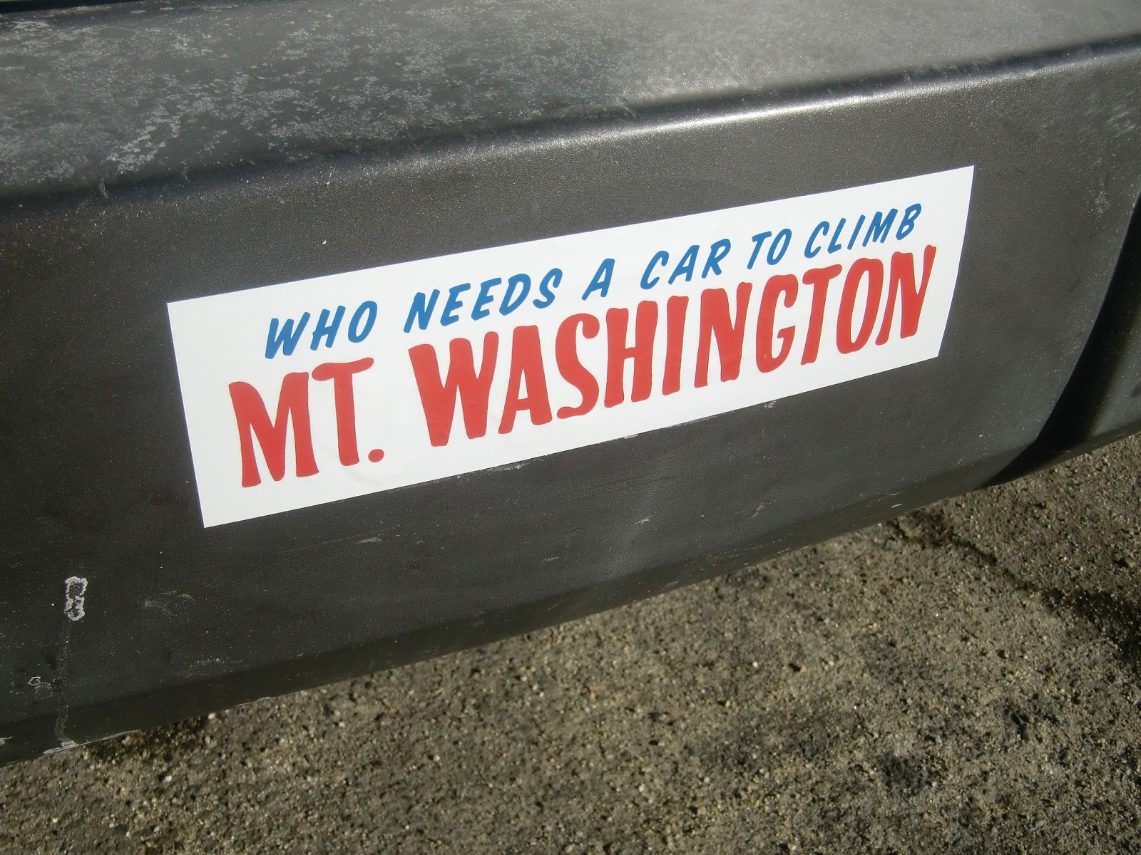
So as I drove in the crisp darkness, I was geared up and feeling good about the weekend and the prospect of finishing my list. It seemed like a long time since I decided to do The Forty-Eight, and the many dreadfully early mornings spent driving to New Hampshire all seem to blend together. I was looking forward to Mt. Carrigain (4700'), looking forward to finally climbing the mountain that sent me back before summiting a couple of months earlier. I was looking forward to the mountains in general, with their fall colors whitening to the snowy slopes of winter. It would be a good weekend.

ice on Signal Ridge trail
I picked up John at about 5:30, and we stopped at Dunkin' Donuts for coffee and breakfast before hitting the Mass Pike up to 93, driving North as the sun slowly presented itself. John had procured the use of a ski condo that belongs to some friends of his, so we wouldn't be camping or spending the night at the "Hiker's Paradise", the motel in Gorham that - according to on-line reviews isn't such a paradise after all - as we were considering. The day came, and we turned onto the Kancamagus Highway and took Bear Notch road to 302, and onto Sawyer River Road, which would take us to the trailhead. Sawyer River Road had been closed earlier in the year due to Irene's damaging effects, but it was open now. It had washed out - I had walked it earlier in the year while it was closed - but now was shored up with an asphalt reinforcement, making it safe to drive on again. It's always a good idea to call the AMC or the Forest Service if there's any question about road closings.

We parked at the trailhead, and were surprised by the number of cars present. Looks like people were taking advantage of the newly opened road, especially since the weather was starting to turn and this is probably one of the last weekends to hike in non-winter conditions. We exchanged pleasantries with some other hikers also just starting out, and hit the Signal Ridge trail at about 9:30. We were looking at mileage of about 10 miles today, so we wasted no time. I like trails like this; pretty easy going on for a couple of miles before the elevation really hits. Gives you some time to find your pace, and your trail legs. The trail had been diverted from the start, again, due to Irene's wrath, and the new trail was soft and spongy, having not been pounded down fully by trampers. After 1.7 easy miles we hit a junction with the Carrigain Notch trail but we stayed to the left, toward the summit. The trail became increasingly steep, and frost appeared. As the feet piled on, the frost turned to snow and ice. The first time I've hiked in snow since Moosilauke in April! It wasn't deep, but it made the footing a bit more challenging. A couple of areas of rocky scrambling, coated in ice, were tricky, but all in all, it was a pretty manageable climb. Views east, toward Mt. Lowell and Mt. Nancy were beginning to open up. A lot of friendly folks were on the trail, which I like; we were all enjoying this cold, crisp, clear day in the mountains.
Southern Pemi border, Carrigain summit

We climbed steadily, and finally emerged onto a rocky outcropping. I realized this is where I'd turned around before, when I came out in July, due to adverse weather and fog. John and I joked that this was my "personal summit". I hadn't ever come this close to completing a mountain and failed, and I felt a bit foolish for leaving when I was so close. But, I also wanted to return to Carrigain because I'd hear the views were amazing, and the last time I was here I could barely see my hand in front of my face. I wasn't disappointed; the vista afforded a jaw-dropping view out to Crawford Notch and the Presidential Range. Ancient Mount Washington, as it had when I decided to undertake this project, stood majestically in the distance, snowcapped. It was very cold and windy here, and we weren't even at the summit yet. Though, we could see it, the observation tower at the top looked to be maybe another 20 minutes' hike. We dropped our packs for a moment, ate a snack, and marvelled at the view with our fellow hikers.

Carrigain summit
The White Mountains are one of the oldest mountain ranges in the world. They are small, comparatively to other ranges, but they are ancient and craggy and exposed, and the trails don't include switchbacks as often as many mountains, making the task of climbing them that much harder. Some folks from out West, or who hike in the Rockies, consider 4000' mountains merely hills. But, what some don't realize is that Mount Washington has an elevation gain of 4250 feet in 4 miles, while Mt. Whitney has an elevation gain of 6100 feet in 11 miles. It all depends on where you start from. Add to that that the Whites - Mt. Washington and the Presidentials in particular - have some of the most erratic and dangerous weather in the world, and people begin to understand the weight of hiking these "hills."

We eventually made the final push to the snowy summit, dropped our packs at the base of the observation tower, and climbed the stairs to the top. A dozen or so folks were milling about; eating lunch and sitting in strategically sunny spots, enjoying the views. The panorama from the apex of the tower was breathtaking; so was the freezing wind! According to the weather report, the temperature was 20 degrees with a 30 MPH wind - putting the wind chill at about 0. My awesome new Arc'teryx jacket cut the wind nicely, and I could have added my down jacket, but didn't. No amount of cold could have detracted from the glorious views. The view from the tower on Carrigain offers an unencumbered vantage of something like 43 of the 48 Four-Thousand footers in the Whites. We took some photos, lingered a bit, and then descended the tower, out of the wind, and found a sunny spot to sit for a while. It was about 1:30, and after a while, we headed back down, the way we came.

The hike down was pretty uneventful; a lot of icy spots required care to cross safely, but no spills occurred. A lot of folks were hiking down the mountain at the same time, to the point where occasionally a traffice jam would occur, usually at a tricky scramble. Aside from a quick pit stop for me to moleskin a blister I felt growing on my toe, we made pretty good time, and we back at the parking area at about 4:30. We'd hiked Carrigain in 7 hours, about an hour and a half under "book time" (the AMC White Mountain Guide's estimation of hiking times) and aside from some sore Achilles tendons and knees, we were feeling pretty good. We changed into some clean clothes, and headed back out to 302, toward the AMC Highland Center, where we planned on procuring some well-deserved grub. However, dinner wouldn't start til about 6, we learned when we arrived, so we continued on down the road. After pulling off the road to join other gawkers to take some pictures of Mt. Washington in all its snowy early-evening splendor, we stopped at Fabyan's in Bretton Woods for some burgers and chili. It was delicious.

Mt. Washington from Crawford Notch
We headed to John's friends' ski condo, which was amazing. It's a big, spacious, two-story place with high white walls and carpet, and a distinct early-90's decor vibe - but very cozy. It was an unexpected pleasure to end a hard day of hiking laying on a white leather couch watching Ocean's Eleven, taking a hot shower and sleeping on an actual bed, instead of crashing in a tent or in the back of my truck. We were planning on doing Mt. Cabot (4170') the next day, weather permitting, and we kept an eye on the forecast. Looked like rain was possible, but it might just miss the area we'd be hiking. I went to bed, hoping for decent weather and very much looking foward to summitting number forty-eight. I crashed hard and slept a solid 9 hours.

Sunday morning came quickly. The first thing I did was take a look out the bedroom window, hoping rain wouldn't be coming down in sheets. It wasn't; just a bit grey and damp. After making coffee, we packed up our stuff and headed out about 9. It sprinkled on us a bit as we journeyed toward Gorham, but never too much, and looked like the weather might hold out. We turned toward Berlin, and eventually found the entrance to York Pond road off of Route 110. This would lead us into the backcountry, eventually onto a gravel road, and to the trailhead that would take us to Bunnell Notch Trail. We were driving along the road, when I saw a large, dark shape ahead, that looked to be in the road. My mind and my middling long-distance vision were trying to out the pieces together when John said, somewhat nonchalantly... "Moose." And then a bit more emphatically, "MOOSE." I stepped on the brake, and it finally sunk in that there were 3 moose - what seemed like a small male and two adults - on the right side of the road. As we drove slowly toward them, I marvelled at their size and beauty. They soon saw us, and quickly ambled off and disappeared - unexpectedly gracefully - into the woods. It was exciting, and I considered it a good omen for my final peak. The mileage today would be about 9 miles.

Kilkenney Trail
We passed through the Berlin Fish Hatchery area, and after a while we located the trailhead. One other car was there; a very different picture from the happening scene that was Mt. Carrigain. It was grey and drizzly, but had warmed up considerably from the day before - this change was apparently the beginning of a warm front moving through - and the temps were supposed to be up into the low 50's. All in all, it wasn't bad weather for hiking, though the Bunnell Notch trail was pretty wet and boggy. I wore my Vasque boots - the trails were far too wet for my Merrill hikers - and we started up at about 10:30. The first mile and a half or so was pretty flat - the beginning stretch was an easy hike through open, muddy marshlands, and soon we arrived at a sign indicating that the Bunnell Notch trail turns left. The trail entered the autumnal woods, and quickly began to climb moderately. The trail was a bit obscured at points; the leaves made it blend into the forest, but it was still fairly easy to follow, especially since it skirted a brook most of the way. It was certainly wet, as some points I was unsure if it was raining or if a breeze was simply causing water to sprinkle from the canopy above. The forest floor was yellow with wet leaves, which occasionally made footing tricky as it obscured the muddy, rocky trail below. The climbing was easy, moderately hilly, and passed over a couple of rough log bog-bridges as we approached the junction of Kilkenny Ridge trail at about 3 miles in. The trail swung right as we hit a cutoff that brought us north toward the summit and soon saw the junction of the no-longer-maintained Mt. Cabot trail. Apparently, due to a dispute with the landowner of the property near this trail, it is no longer an option for the approach to Mt. Cabot, which is why we took the Bunnell Notch trail from the east. I would like to, at some point, explore the route from (reportedly beautiful) Unknown Pond down to Cabot from the north, which brings you over The Bulge and The Horn, and which you can work into a triangular loop with Bunnell Notch. We passed the old trail and began to see some elevation, and the mountain grew snowier and rockier as we climbed around it. At this point we ran into a wet, somewhat bedraggled couple - the owners of the only other car at the trailhead - who greeted us with a cheery "Hey, we aren't the only crazy ones!". We chatted for a minute; the woman was working on her 48. John mentioned that it was my last peak, and she gave me an enthusiastic high-five.
Cabot cabin

We climbed through increasingly wintry conditions until we finally came upon the cabin that sits near the top of Mt. Cabot. It's maintained by the Boy Scouts, and on this particular raw and wintry day, is a welcome reprise from the elements. We drop our packs in the cabin and we make our way to the summit. Any other time, this would be a fairly inconsequential place - a small, viewless, snowy clearing surrounded by stubby evergreens - but for me, it's the completion of a quest I started six months before. To climb The Forty-Eight. And I'd done it. The cold chill left my bones as the warm satisfaction of a journey completed overtook me. I ceremoniously drank a Long Tail beer that I'd brought for the occasion, and we returned to the cabin and snacked on sausage, before packing back up and heading down.

We trudged along the trail, back the way we came, through the mud and the muck and the wet leaves. There was no one else on the trail. As we came down the mountain and out of the woods, and hit the final stretch, the rain finally began to open up a bit. I pulled the hood of my new rain jacket up over my head, and the sound of the rain hitting it made me feel a bit as if I were in a tent, cozy and warm, waiting out the weather. Eventually we made it back to the car, a bit damp but no worst for wear. Now the peak was officially conquered. Now the list was done.

The last peak of my list is not the end of my time in the White Mountains. On the contrary, it's only the beginning. As I flip through "Wandering Through the White Mountains", the book I picked up at the Highland Center a couple of months ago, I realize that even having done the Forty-Eight, I've only touched the tip of the iceberg. One could spend a lifetime in these mountains, exploring the trails, summits, and cols. They foster a sense of community, of sharing, of comaraderie that I've rarely experienced outside the boundaries of the backcountry. I've begun friendships and strengthened friendships in these mountains; the wilderness had tested my resolve, my courage, and my belief in myself. My love affair with the Whites has only begun, and I can't wait to see what's around the next bend in the trail.