 I figured it was about time to tackle Owl's Head (4025'), one of the more remote 4000 footers in the White Mountains. Situated in the Pemigewasset Wilderness west of Franconia Ridge, Owl's Head is long a thorn in the side of peakbaggers attempting to accumulate all the 4k peaks. Owl's Head is often left til the end of the list for a lot of hikers, due to the fact that the easiest route to it, and back out, is about 18 miles (maybe more like 19 with the additional mileage to the "new" summit), and there are absolutely no views from the top. There are many things to like about this little mountain, however.
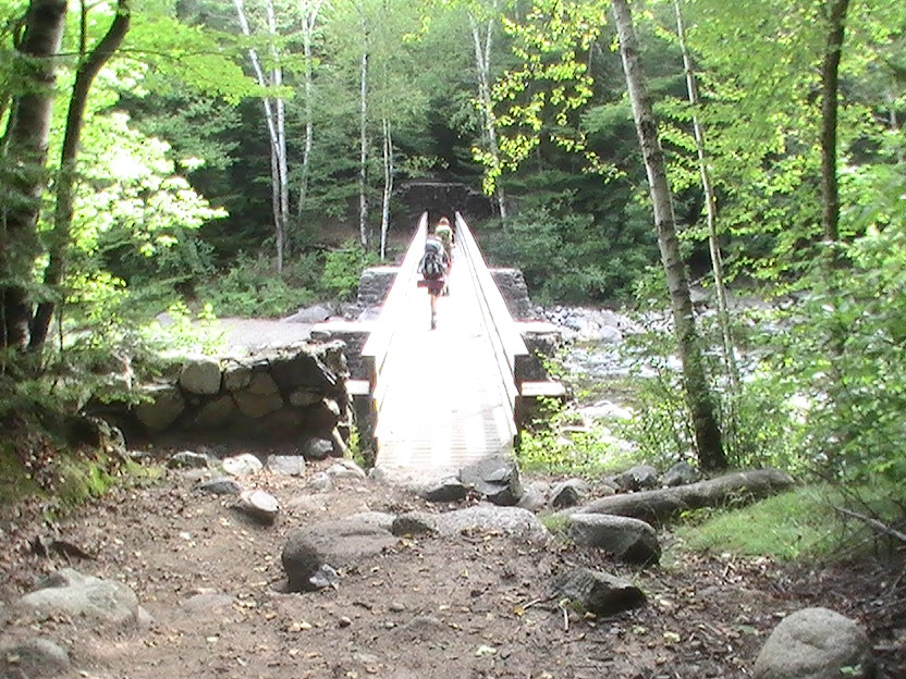 |
| hikers crossing a bridge |
I was a bit nervous about the slide, but it was actually quite fun. Hard, but fun. There are few places that are actually treacherous; even if you fell you'd likely just slide a few feet back down and maybe get scraped up. A couple of dangerous-looking cliffs were adjacent to the trail, but easily avoided. I was hiking at this point with a very friendly father-son duo, Henry and Jeff. Henry was trying to finish the 4000 footers before his eleventh birthday! He was a strong little hiker, and didn't complain once, and his dad and I had a lot of welcome conversation.
 |
| Add caption |
After a while we cleared the exposed part of the slide and ducked into the woods, still climbing at a steep incline, but at least now sheltered from the midday sun. At this point were were all very tired and now devoid of views, it turned into a full-fledged slog. Every bend, we'd say surely this is it! But no... more climbing. After about 15 minutes of this the trail finally leveled out, and we approached the "old" summit.
There's an old summit and a new summit. The old summit was the one they used to believe to be the highest point on Owl's Head, but some busybody with a GPS found that there is actually a higher spot. All these trails are officially unmaintained by the AMC (still haven't gotten a clear answer as to why...) but they are pretty well trampled, due to its inclusion on THE LIST. Many say no hiker with all his marbles would visit this mountain, with its long approach, super-steep slide, and viewless summit, had it not been included in the 48. Apparently the AMC doesn't require those who climbed Owl's Head before the new summit was discovered to go back and get the new summit, but many do anyway. So, after passing the old summit, we followed a maze of cowpaths and eventually got to the new sucker, where a large cairn has been built in a nondescript wooded area. I think so many paths now exist because everyone just kind of finds their own way, and creates several rough paths to the true summit. What happens when no official path is established.
 |
| uneventful summit |
We waded across the brooks again, the ice-cold water welcome on my aching feet, and at this point I hiked ahead and told Jeff and Henry I'd see them at the trailhead. My pace was slightly faster than theirs - but not by much - and I just wanted to shift to a higher gear and get this day done with. After seeing everything in reverse, I found myself again on the wide, flat Lincoln Woods Trail, and began to see families and dayhikers taking an afternoon jaunt. Eventually the suspension bridge presented itself, and I skirted down the side down to the river and stuck my feet in again. Ahhh. Nice way to end a hike. It was about 6. Henry and Jeff walked across the bridge a few minutes later, and we exchanged pleasantries and said goodbye. Hikers are great folks.
I got back to EmmyVue and got into my Birkenstocks and a dry shirt before driving a short way down the Kanc to Big Rock, where I pitched my Coleman tent at the same spot John and I stayed at a couple of weeks before. I paid the fee, got some firewood from the caretaker, and then headed into Lincoln to the Common Man, a great little bar/grille/ski lodge, where I met Dana and her dog Gretel. Dana and I had a couple of beers and some food while Gretel dozed in the car, and after a while headed back to Big Rock where we built a fire. Before long we turned in; I was bushed.
 |
| Gretel, looking for large land mammals to terrorize |
At one point, out of the corner of my eye, I saw a big black creature tear down the mountain, about 15 feet to the left of the trail, obscured by trees. I assumed it was Gretel but simultaneously was surprised at the much-louder-than-normal noise she made crashing through the thickets and the speed at which she ran. I looked ahead, and Dana, with a look of surprise and concern on her face said "That was a bear!" At first I thought she was kidding, but then I saw Gretel far up the trail, looking down at us, a bit baffled. She'd apparently startled a small black bear, who then took off like a shot back down the mountain. It was exciting, my first black bear encounter! Even though all I saw was a black streak, it's a first. I really couldn't believe how fast it moved. We proceeded with caution.
About halfway up the Hale Brook Trail the grade steepened, and a couple of little switchbacks carried us around toward the summit, positioned to our left. It wasn't extreme but I was dragging, maybe due to the long day I had up Owl's Head. Of course Dana barely broke a sweat (:P). The weather was clear and warm, a great day for hiking. Eventually the trail opened to a partial view out toward Tom, Field, and Willey, and after a couple more minutes, we found the summit. It was a small clearing surrounded by trees, not much view, but with a huge pile of rocks, the top of which granted a limited view of the surrounding mountains. Though mostly viewless, it was a very nice open summit; the sky was bright blue and the midday sun was warm, a nice change of pace from the humid woods we'd been hiking in. We had some lunch and lingered on the summit, resting and chatting. Gretel enjoyed licking the inside of my tuna-pouch quite clean, and we tried to get her to sit still for a photo on top of the rocks. Almost.
 | |
| Atop the Hale Summit rockpile |
We eventually got down to Zealand falls, and took a break at the top, where Gretel found a natural waterslide down into a basin, which she rode down a couple of times, her legs flailing around. Zealand falls is an incredible natural occurance, and the mind reels at the infinite number of shapes water, given enough time, can carve from rock. Ice cold water cascades down from shelves of varying sizes, creating clear basins and pouring down again, over and over. Swaths of smooth, hot granite, baked in the sun, provide excellent places to lounge and lose track of time, contemplating these ancient falls.
We hiked down to the hut, where we took another break and leisurely watched the visitors come and go. A northbound thruhiker shared his adventures, and a somewhat socially awkward AMC guy was inviting folks to look at sunspots through a telescope. Gretel tried to infiltrate the hut, probably smelling something delicious inside, but we intercepted her. After taking in the beautiful view of Zealand Notch opening before us for a few minutes, we hiked down a short but steep rocky descent from the hut and tramped north on the fairly easy Zealand Trail. Easy, but quite scenic, with rustic bridges over ponds, well-worn paths, and nice views of Mt. Hale on the left and many peaks to the right. After reentering the woods for a while, we eventually hit the parking area. The trek down Zealand Trail seemed an awful lot shorter this time than when I did it coming back from the Bonds. Maybe because my pack was lighter, or I hadn't hiked as many miles that day, or because of conditioning, I'm not sure.
We walked back down the road for about a mile to get back to the car. Our mileage for the day was about 8.6 miles, and other than the Hale Brook Trail, was relatively easy; and the hard stuff was out of the way pretty quick, leaving us to enjoy the day on some of the nicest trails in the area. No super-amazing views, but a side trip up to Zeacliff would be a fantastic addition to this hike. I'll definitely recommend this one to people looking for a nice tour of the Zealand area.
Another beautiful, challenging, and memorable weekend in the White Mountains, with big miles and great conversation.
Looks like your hikes are going well. How close now?
ReplyDeleteHenry and I finished on Aug. 31st with a Pemi-traverse (19.5 miles) to wrap up with Zealand and the Bonds. Look at VFTT.org -- you'll see our post.
Good luck -- and great hiking with you!
Jeff&Henry